


3D technology 'to drive border security'
Dubai, September 17, 2012
Abu Dhabi-based Bayanat for Mapping & Surveying Services Security will showcase how 3D technology can be used to drive next-gen border protection at key forum in Dubai later this month.
Senior security and intelligence directors and managers from across the GCC will take part in the annual Smart Border Technology Forum, being held under the patronage of Lieutenant General Sheikh Saif Bin Zayed Al Nahyan, the UAE’s Minister of Interior and Deputy Prime Minister, on September 24 at the Al Bustan Rotana hotel in Dubai.
Over 150 regional and global border protection and management experts are expected to participate in the event.
The forum will cover the full spectrum of border protection technologies and solutions. Among the areas to be featured are Command & Control, Communications, Computers, Intelligence, Surveillance and Reconnaissance (C4ISR); Advanced border imaging/screening; and border surveillance. The prestigious event will be hosted by the General Directorate of Residency and Foreign Affairs – Dubai.
One topic that is expected to be in focus at the event is the need for more integrated solutions for monitoring boundaries, vulnerabilities, and strategic locations or points of interest.
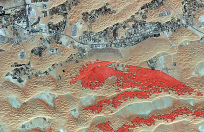
Bayanat for Mapping & Surveying Services will showcase during the forum how CCTV cameras, infra-red and laser sensors, mapping and surveying and GIS technology can all be combined to achieve more effective monitoring, protection and control.
Bayanat will use 3D simulations to demonstrate how integration is the best approach for applications related to land demarcation, urban planning and other related areas as well.
“Factors such as social unrest and smuggling are bringing border protection to the forefront of regional discussions on homeland defense and other security domains,” said Khaled Al Melhi, CEO, Bayanat for Mapping & Surveying Services.
“The preventive nature of border protection makes it an optimal approach to homeland security policy, which is why the Smart Border Technology Forum is a welcome platform for discussing the future of this field. It provides an ideal venue for us to discuss how GIS, mapping, surveying and other geospatial technologies can be integrated to create comprehensive, reliable and robust solutions for safeguarding national borders.”
The Bayanat delegation will reveal how the company’s comprehensive line of surveying, mapping and geospatial services are used to support the decision making process in the areas of border delineation and demarcation, border protection and support via geospatial systems, urban planning for emirates and municipalities, and land demarcation.
During the forum, Bayanat will also showcase how Viewshed Analysis – a common function of GIS software that profiles an area on the ground visible from a specific location or locations – is vital to border protection planning and implementation.
Participants are looking forward to hearing about the UAE’s recently implemented E-passport technology, automatic E-gates and integrated biometrics systems. – TradeArabia News Service


